About Moreton
Moreton Electorate
The Division of Moreton is an Australian Electoral Division in South-East Queensland.
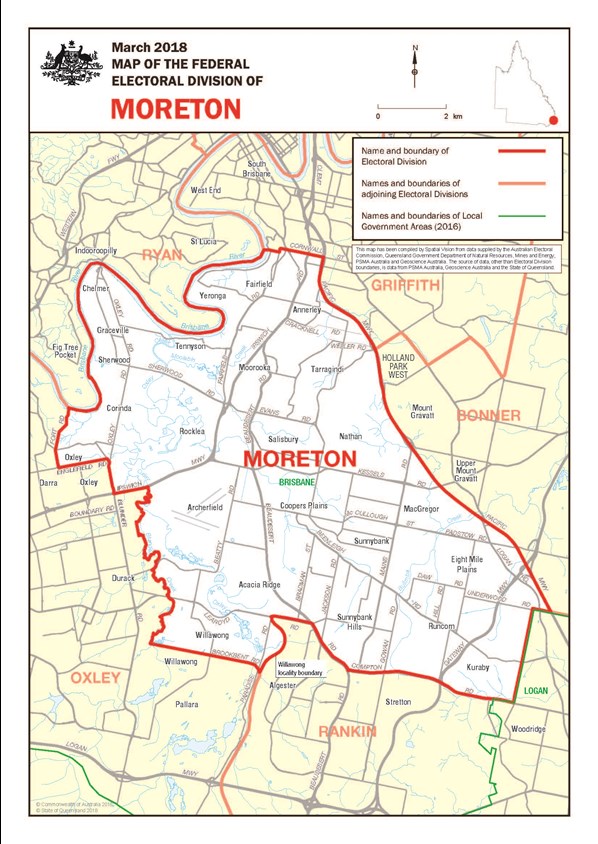
Please look at the electorate map or visit check.aec.gov.au to check your enrolment.
The division was one of the original 75 divisions contested at the first federal election in 1901. It is named after Moreton Bay, though successive redistributions have resulted in it no longer bordering the bay; it is now completely landlocked. Nonetheless, it has retained the name of Moreton.
The seat is known for having decided the 1961 federal election. The Liberals only won the seat by 130 votes to give the Coalition a bare one-seat majority; had 93 Communist preferences gone the other way, it would have resulted in a hung parliament.
On its current boundaries, the seat is very multicultural, with significant Asian, South Eastern European, Arab and African population in the southern part of the electorate in the suburbs of Sunnybank, Sunnybank Hills, Macgregor, Robertson, Acacia Ridge, Kuraby and Moorooka.
Moreton covers an area of approximately 111sq km from Fairfield in the north, Chelmer, Corinda and Oxley in the west, Eight Mile Plains and Kuraby in the east to Sunnybank Hills in the South. The main suburbs include Acacia Ridge, Annerley, Archerfield, Chelmer, Coopers Plains, Corinda, Fairfield, Graceville, Kuraby, Macgregor, Moorooka, Nathan, Robertson, Rocklea, Runcorn, Salisbury, Sherwood, Sunnybank, Sunnybank Hills, Tarragindi, Tennyson, Willawong, Yeerongpilly and Yeronga and parts of Pallara, Eight Mile Plains and Oxley.


